Tuesday, July 27, 2021

Pukaskwa Coastal Trail: Day 5


The boys still admiring the White River from the suspension bridge. 


Are we there yet?  Almost. The section from Hatties Cove to the suspension bridge is heavily travelled and easier to follow and hike. We planned to back at the truck in good time and to have lunch at A&W in White River. Boy, a meal that isn’t boiled in a bag will be fine with me! Even if it’s not corn fed beef!

The final out day was relatively uneventful. I ignored a minor toe blister that then got much worse. Just cause I knew we were existing in a couple hours, I still should if properly attended to it immediately. 

We met lots of families and older couples in this section. It was nice to see so many folks heading out to the suspension bridge and back for a day hike. Still a considerable undertaking for sure. 

The showers in the campground were amazing. Best shower ever. After a short 4 or 5 hours on the trail we were out. A good cleaning and a speedy checkout had us in White River for those grass fed burgers. Thanks for an amazing week KD and PR!

If you are considering the Coastal Trail, please check out our final post on this adventure wheee we sun up some of the do’s and dont’s for you. What a trail!


Monday, July 26, 2021

Pukaskwa Coastal Trail: Day 4

Cumulative affect? What cumulative affect? We only hiked 10k yesterday and made it into camp by 6:00pm; we rested for 14hours! Let there be no mistake, the body was sore this morning from the cannula tube affect of slinging 45lbs over the marathoners for about 120 times. The shoulders were sore, the feet were sore, the bodies were sore from ground sleeping etc etc. But our spirits were amazingly high, we were all no doubt by looking forward to that Porterhouse Steak in the Sault tomorrow night!


Picture: my solo Teton tent. I was very happy with this small beast. 3lbs of pleasure, rain fly not shown. 

So it was around this time, mid morning, when no doubt, PR the enthusiastic tourist would remember the scenic route suggestion from the dad/daughter pairing we passed on day 2. The only thing I didn’t want was a late day and/or an injury. By the map, it appeared to be only an extra klick or two, and would likely yield some nice views and swimming opportunities. We took a left, and did the scenic route; and I think we were all happy that we did. The lunch spot right on the coast was splendid. It was a great spot for a refreshing swim and gourmet boil in a bag. At this point, I think we were all picking our favourite meals at this point, knowing that there would be 3 days of excess food that we would not be eating in this trip. 

The sun was strong on the dark rocks. It was a great day all around for hiking, exploring and trail comradeship. I have to say in reflection, this was one of the highlights of the trip!


More water views. Firstly, a sneak look out into one of the countless sheltered bays of the big lake. Secondly, Hook Falls, where we laid our camp for the second time on this trip.  Although the campsite was a couple hundred meters away, we found ourselves drawn to this amazing location not only for the necessary water fill ups, but also to admire the beauty of the falls as we ate dinner. 

Even with the bonus scenic route, the 14k say put us at camp by around 6:00pm, and better off for it. It was a Kat great era evening with a fire and the whole shebang. We would miss these great days and enjoyable nights!

Saturday, July 24, 2021

Pukaskwa Coastal Trail: Day 3


As thoroughly refreshed as a 10 hour sleep after hiking 40km in two days could possibly be, we broke camp. A leisurely breakfast, and an update on the weather through our Garmin inreach mini took most of the morning.

Coffee in a place like this simply can not be beat. PR has yet to find its equal.  Before the forensic photo investigation reveals that the photo of the Garmin is from another location, I’ll say it’s the only photo of the unit I could find and I wanted to represent the significance of it at least once in the blog! Bonus if you can figure out the campground in which the photo was taken. 

The plan this day was was to hike 10km back to Morrison Harbour. Simple right? It would be our easiest and most enjoyable day of the hike. Well maybe not most enjoyable, that could be the outcrops on day 2 or the showers back in Hatties Cove on day 5! To each their own. 

The day 3 hike was fairly straight forward. There is something to be said about having the prior knowledge of the trail to guide you back. There were no surprises and we made great time. We met a group of 5 young ladies making their way south on a very difficult section of trail. Equipped with both a diverse set of attire, as well as attitudes ranging from fun and optimistic to sour and exhausted, this was a rather interesting group. It sounded like they were experiencing the Pukaskwa that 95% of us do!  By that we mean that they were not making campgrounds and that they couldn’t wait to get to the next campground…any campground. While KD and Duff made minor pleasantries and moved on, it is not sure how long PR engaged the group in curiosities, pointed geographical questioning and dad jokes. Eventually our party was back on pace at the bottom of the rocky canyon and on we went northward towards civilization and the services of Hatties Cove . 


Morrison Harbour was simply an awesome site. The water was relatively warm for Lake Superior. Proving for a nice swim and a chance to do some sorely needed laundry. 


If I had a dollar for every time that map was opened and closed I’d have more cash to tip the waitress in the Sault for making fun of KD!

In retrospect, day 3 was how it should be. A distance that was covered in about 8 hours. Arriving at the campsite by 6:00pm, allows for proper housekeeping and enjoyment. Lesson learned. When you hike a trail defined by others, and their goals and itineraries, are you really hiking your hike?

Sitting on the beach, watching the world go by in this small but massive piece of God’s creation, really put things into perspective. It would be interesting to have to deal with people again and their tendencies once we returned to civilization. But we still had 2 days of hiking to go!

Friday, July 23, 2021

Pukaskwa Coastal Trail: Day 2 (Part 2)


Lunch was awesome. In fact, I can honestly say that with the weather and the lack of insects, all our breaks and meals were pretty awesome. Sunny and 75 is a nice country tune, but even better when experienced in person on the trail! 

The hiking was now beginning to get a little more challenging. The trail was starting to become more out on the open, which meant more rock outcrops and rock cairn “inukshuks” to follow. At first, you might think smooth open rock would be easier to hike, and at times you’d be correct, but the elevation gain and loss for hours was very wearing on us, especially those of us with 45lb plus on our backs. I’m not going to name any names. As difficult as this section was between Playter and Oiseau, it is like my favourite! I love the sheer variety of terrain and the beauty of the views. The scrambling around the rocks on the lakeshore provide stunning views, while the beaches are equally impressive. There are sections that you would describe more as moderate rock scrambling than hiking, and would be torturous in the rain. 

It was important to stay hydrated and to take breaks as needed during this arduous stretch of topography. At many points along the trail after lunch our memory of this section eludes us, as we fade in and out of consciousness! I figure I drank over 10L of water on this day, and I still had a thumping headache by 8:00pm when we reached the site. Heat exhaustion (a little bit) was a distinct possibility by this point. 

The boys did very well. I am still hugely impressed at their ability to go 25k on day 2 with 45lbs on their backs. If anyone knows of a Sherpa outfit who is hiring, I can send in their resumes. KD and PRs Sherpa Services. KDPR-SS. That’s either an am radio station west of the Mississippi or one hell of a Sherpa service. 

Making up for the lost 6k on day one and adding it to an already full day 2 proved enormous. I think we all knew leading up to night 2, that although we may have been able to push on, the likelihood of making future campsites or even in maintaining our pace was unlikely. The weight lost per day from the packs was not significant enough to really lighten the load. When we finally arrived at our campsite, thanks to the kayakers who pointed us in the right direction and saved us from even further stumbling, there wasn’t a lot left in the tank. PR wouldn’t even build a fire. It was boil in a bags and off to bed. We had just accomplished the near impossible. Hiking over 25km of very diverse and challenging terrain on Canada’s toughest trail! We would remember this point on the journey that’s for sure. 


Photo: KD proudly displaying his 78lbs of food that he never ate. 

The consensus was that we would head back tomorrow. More so, we would break up the 25k we just shredded into two days on the return. That should make for an earlier night tomorrow and give the bodies a chance to recharge. Perhaps PR might even build us a fire! But remember, this is Pukaskwa and anything could happen…

Thursday, July 22, 2021

Pukaskwa Coastal Trail: Day 2 (Part 1)


Day 2. I wish I could say that after a full nights sleep we were recharged and ready to make up for lost time…but I can’t. Our sleeps were level 3, 2 and 1 for PR, yours truly and KD respectively. But even with that, I personally became rejuvenated with the weather, and the overall amazing environment we were in. We were ready. Our goal was to now make it to Oiseau Bay for our 2nd night. This would put us back on track. We would need to cover 20 map kilometres through some more challenging terrain than day 1 offered. 

KD and PR shared a luxurious tent. Morning started when I could hear, from my tent, PR reacting to opening his eyes and seeing KD smiling at him! Some say creepy, some say brah trail love. Regardless, this camaraderie was my que to get rolling. The routine for me was the thunder box, breakie, pack up tent, and coffee…and then wait. The boys eventually worked out a routine that was neither practical nor efficient, but highly entertaining as I sipped my morning Java. In reflection, these simple moments in the trail were awesome, I thoroughly enjoyed the camp time in Pukaskwa. 


By 8:45am we were on the trail, after a short side trail back to the main one, we were greeted by a couple ladies who were heading out on their final day. There is no greater skill/asset for this trail than the cumulative mindset of a seasoned hiker. These two ladies projected such confidence in volumes even bigger than KDs pack. It was a pleasure chatting with them, and it gave us confidence for our big hike we had for the day. 

The inland section of the coastal trail that we first faced was quiet, shady and green, not at all unlike a PR only 2 beers in on St. Paddy’s day. Perhaps I’ll interject a few more pictures into the blog at a later date to show this. About an hour and a half in, we met a nice father daughter hiking team. This had us thinking of our buddy Mac who was planning this hike in August with his daughter. Hopefully our experience can be of benefit to his planning and hiking. The couple was making good time and told us that Oiseau Bay was “just a beach”, something that would linger in our vernacular for some time. Also of note was the scenic coastal loop off the main trail that would only add a km to the return journey but would be well worth it in terms of Superior beauty. I knew faster than a fart that PR would be all over this and that there  would be no way of avoiding this scenic route on our return; I immediately mentally prepared for this. We covered the 7k to Morrison (where we were to have made it yesterday) in just over 2 hours. We all agreed that making camp at HF was the eight call. Although it made for a longer day 2, we really had no other options. Too early for lunch we pushed on from looked like some amazing campsites at Morrison. 


The picture you see does not do the micro elevation gains and loses any justice. This segment of the trail, although stunningly beautiful as it skirted the inland sea, was an arduous hike with the heavy paks. I imagine this section in the rain would be exceptionally slow as to avoid a slip. The trail was slow going, and energy consuming. It’s funny actually, this is a trail where the faster you can actually hike, the fewer the calories you likely consume. By the time we reacher Playter Harbour, we were ready for the boil ina bag lunches. I should add that a typical day of food for me was granola with powdered skim milk and coffee for breakfast, a boil in a bag for lunch and for dinner with trail mix, and 2 protein bars as snacks at different points in the day. 

We were feeling good after lunch but still had a long way to go to get to Oiseau Bay. Our plan was still in tack! Our minds were on track and we were feeling it, but how would we feel by Oiseau…and when would we get there?


Wednesday, July 21, 2021

Pukaskwa Coastal Trail: Day 1


Let’s hit the trail. Our Day 1 plan was to make it to Willow River at approximately map kilometre 16. Now when you hear 16km, you think that’s a pretty reasonable day distance. Even at a slower pace, it seems a fair walk. This is Pukaskwa. 

The first 2km were excellent and as expected. Then the detour. Yes, the boardwalk across the marsh was closed. We were not told this and we were not mentally prepared. However, it wouldn’t have stopped us from doing the hike and we prodded along. And prodded it was. Adding a 5 km detour through a swampy hot mess did little to boost our mood. Adding 5k and at least an hour of time, now put us behind the eight ball. An added factor in this bonus hike was the sheer energy loss and mental downer. We traded a 300m boardwalk “walk” for a gruesome gruelling grotesquely underestimated crawl around the worst of the swamp. The staff hacked out a path that was followable, but it totally zapped our time, energy and spirit. Sadly, the prospects of completing our hike as planned changed dramatically within the first hour of this multi day plan. 

Back on the main trail, sweaty, tired and disheartened, we made good time to PH1 for a break. Platter Harbour is the first campsite you’ll see on the Costal Trail heading south. It’s beautiful. We snacked and tested the water systems. 


We had covered only 4km on the map in over 2 hours. This is Pukaskwa. The boys and their fancy watches had us over 10k. But hey, we were backpacking and loving it!  We pushed on and made it to the world famous White River suspension bridge. What a beauty. A highlight of the trip. By now it’s already getting later in the day and our energy is dropping. Carrying the weight of the packs was clearly not something the marathon runners weighed as heavily into their demeanour equations for this hike. Now it was the real deal. I found any one segment or any one day was never the issue, but the fact that the strain was cumulative, and that you would feel all previous days strain plus the day of, was what brought you down. 


By plan A, we were still only 1/2 way to Willow and it was now around dinner time. The amazing late day light of the Superior region allows for some late day hiking, but pushing it to dark when your tired is not smart. We pushed on a big more. After a frustrating error in trail sign reading, we detoured down to CHF1 and found a happy couple rather nervous (we think they thought we had their campsite booked). Again, losing more time, we found ourselves with a decision by the time we got back on the trail and we route towards Hook Falls and our eventual destination of Willow River. The decision at HF was this: It’s almost 8:00pm and we have 6k to Willow. We are tired, hungry and there is a perfectly good campsite right here. We came to a quick consensus to make camp and try and make up our lost distance tomorrow. 

I had a sneaky suspicion that our proposed trip plan might now be out the window from one small decision by the park, and one giant detour for mankind! Yes, the boardwalk detour was indeed looking like it might have some lingering effects. 

The night at Hook Falls was awesome. We made camp, consumed some boil in a bags, enjoyed a campfire and some great stories. We now new what we were up against. The plan would be to rise and make it to Oiseau Bay for night 2. Yes, the plan would still be to make our reservation at Oiseau for night two. This would require a map distance hike of 21km. Keep in mind, the famous map warning of map distances are approximate. We would soon learn that 21k on the map equally something much more in reality. As we retired for the night, I think we all knew we had a big day ahead of us! No Shit Sherlock!  


Tuesday, July 20, 2021

Pukaskwa Coastal Trail: The Lead Up!


O the anticipation! With only 16k planned for day one on the trail, we decided a leisurely drive from Ottawa to Sault Ste. Marie was in order. It turned out there was a great steak waiting for us at Chuck’s which was right beside the hotel. We chatted about the daunting adventure ahead, and interestingly enough, talked a lot about that steak during the daunting adventure! 

Getting up the next morning and continuing the shorter drive to Pukaskwa had us stopping in Wawa for a coffee and lunch before rolling into the campground around 1:30pm. After a brief mandatory orientation session with park staff we were on our way. 

The drive up the east side of the big lake they call Gitche Gumee is truly a pleasure in itself. This lake is stunning, you could see how some of the early European explores mistook it for the Pacific Ocean. Infact, perhaps the fancy watches of PR and KD thought it may have been the Pacific as well if they were tracking the mileage from Ottawa. 


Pukaskwa Coastal Trail: Preparation


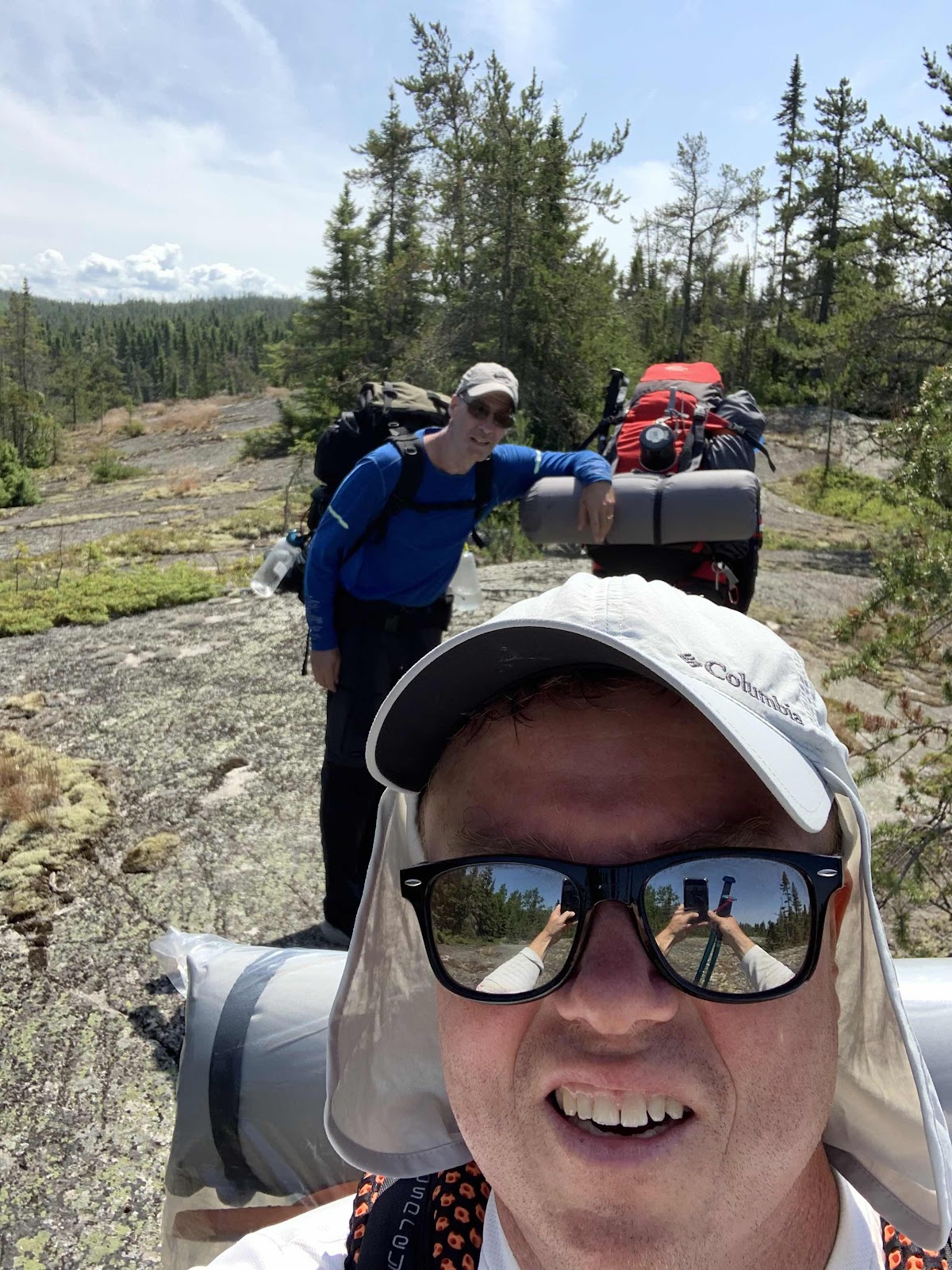
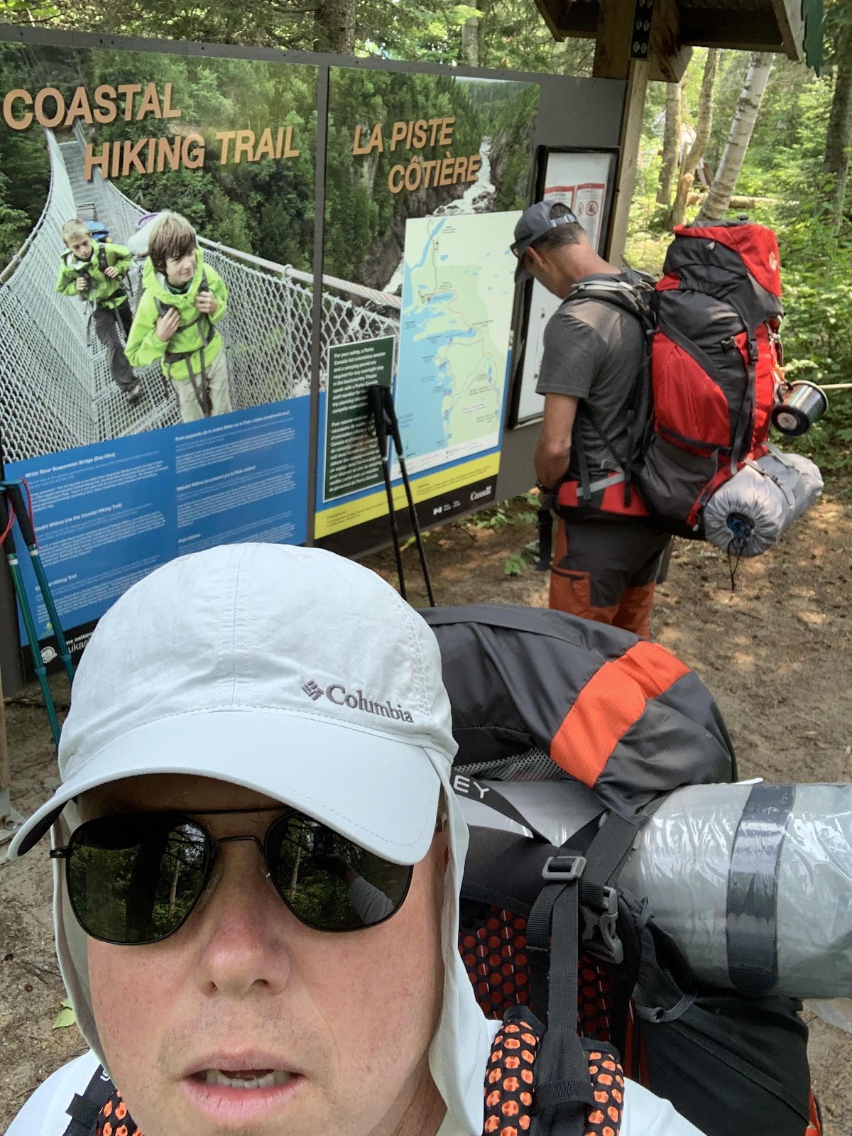
To be honest, my preparation for this hike started in earnest over two years ago. My trail partners for this trip included PR and KD. PR was the first to commit to this hike with me and he probably started his planning three or four months ago. KD was an enthusiastic late joiner who began his trip planning after a shared breakfast about 10 days prior to us jumping in the F150 for the drive to Sault Ste. Marie! I was super psyched to have these fine gentlemen join me on this adventure. These two trail runners and overall fine middle aged  athletes, qualified for the Boston marathon two times and completed it at least once. How hard could the Coastal Trail be after completing the Boston marathon? 

Planning is everything, proper planning can be the difference between an enjoyable trip and an arduous journey. I’d say our preparation was somewhat successful but, as you will encounter repeatedly throughout these blog posts, weight matters. I can’t emphasize enough how important it is to travel as light as possible. This includes getting your own body in shape and not carrying too many extra pounds, as well as what you put in, on and around your pack that you’ll be carrying on your back. As the boys got used to me saying every little bit adds up. If you find yourself saying it’s only 2 ounces or it’s only 3 ounces, think about it, if you are saying that 10 or 12 times… You do the math. 

I mentioned weight, I took my pre-training seriously this time around and I’m proud to say I started this hike weighing 10 pounds lighter than I did in 2019. My pack at weigh in for this hike was also 35 pounds (down from over 40).  Between my weight and my pack, I started this hike almost 20lbs lighter than my previous attempt in 2019. Additionally, as I mentioned in the forward, our pace at the time combined with my overall trail weight, caused my knees to give out on me after 35 km of hiking over just a day and a half! Our trip south was over in 2019 much earlier than anticipated. 

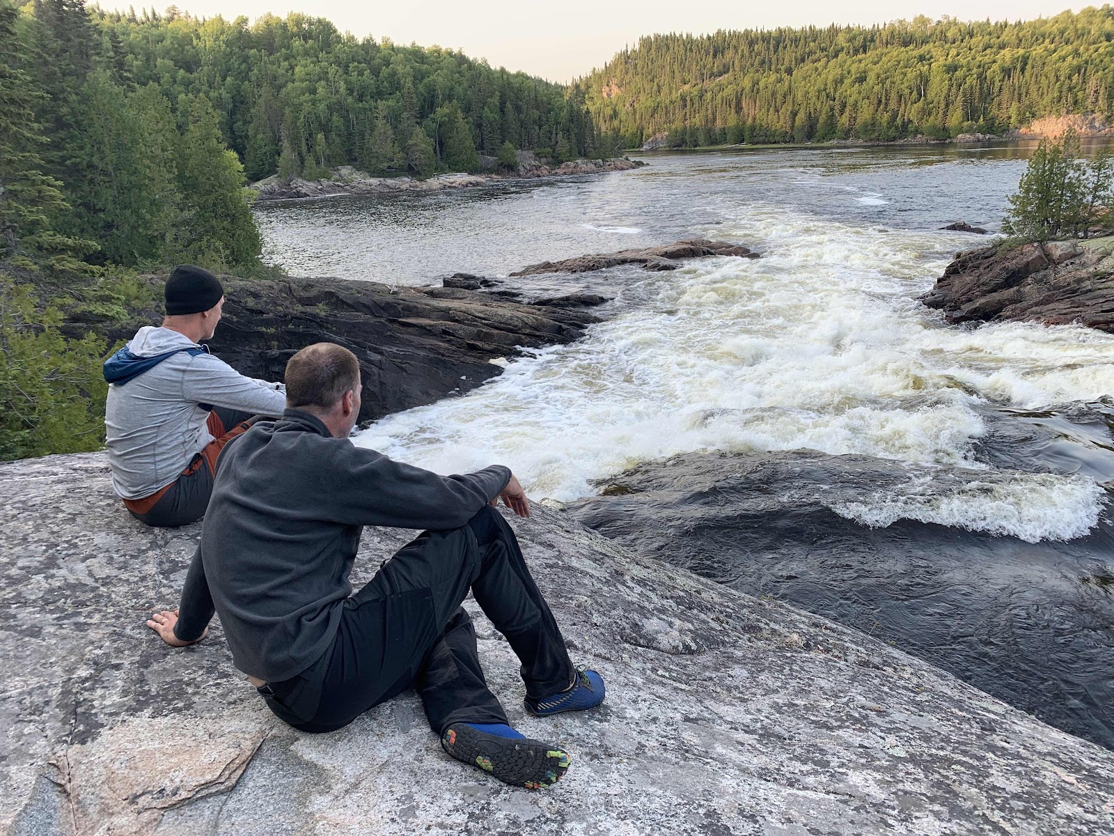
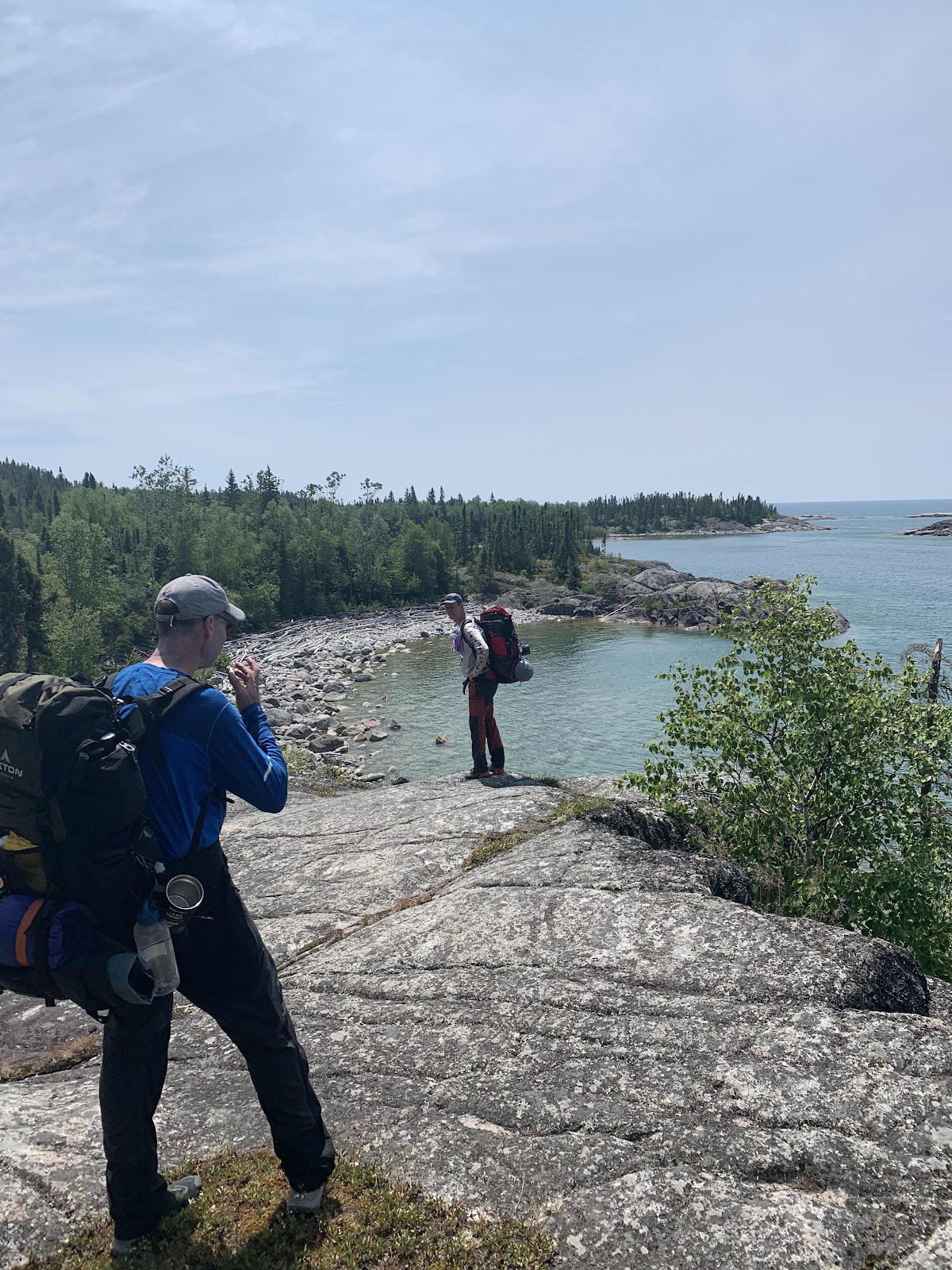
I am happy to say that this time around, lesson learned, my knees were fine in fact everything was feeling pretty good this time around at Oiseau Bay or map mile 30km. We will get more into the specifics as to why we turned around on this trip at Oiseau Bay, but I’ll say that in a group Hike, just because one hiker is feeling “OK”, that’s not good enough for continuation. 

As you may have determined, the most important thing to think about in terms of preparation is the weight of all your equipment and yourself. The lighter the better. After that you need to start thinking about equipment and food. Luxuries really aren’t something you should be thinking about on a trip like this. You will be amazed that just how heavy the necessities are, especially if you are planning for a longer duration hike where every extra day means more food.

Equipment. Before I get into the nuts and bolts of all the equipment is that we invested in, first and foremost a Garman in reach mini was obtained. This device was priceless as it allowed us to stay connected with family through satellite text messaging and it allowed us to retrieve weather forecasts which could help determine our path forward or backward. Most importantly, an SOS function would of relayed our coordinates to the authorities should we have need a medical evacuation. Obviously a good map and compass was part of the kit, as well as knowing how to use them. 

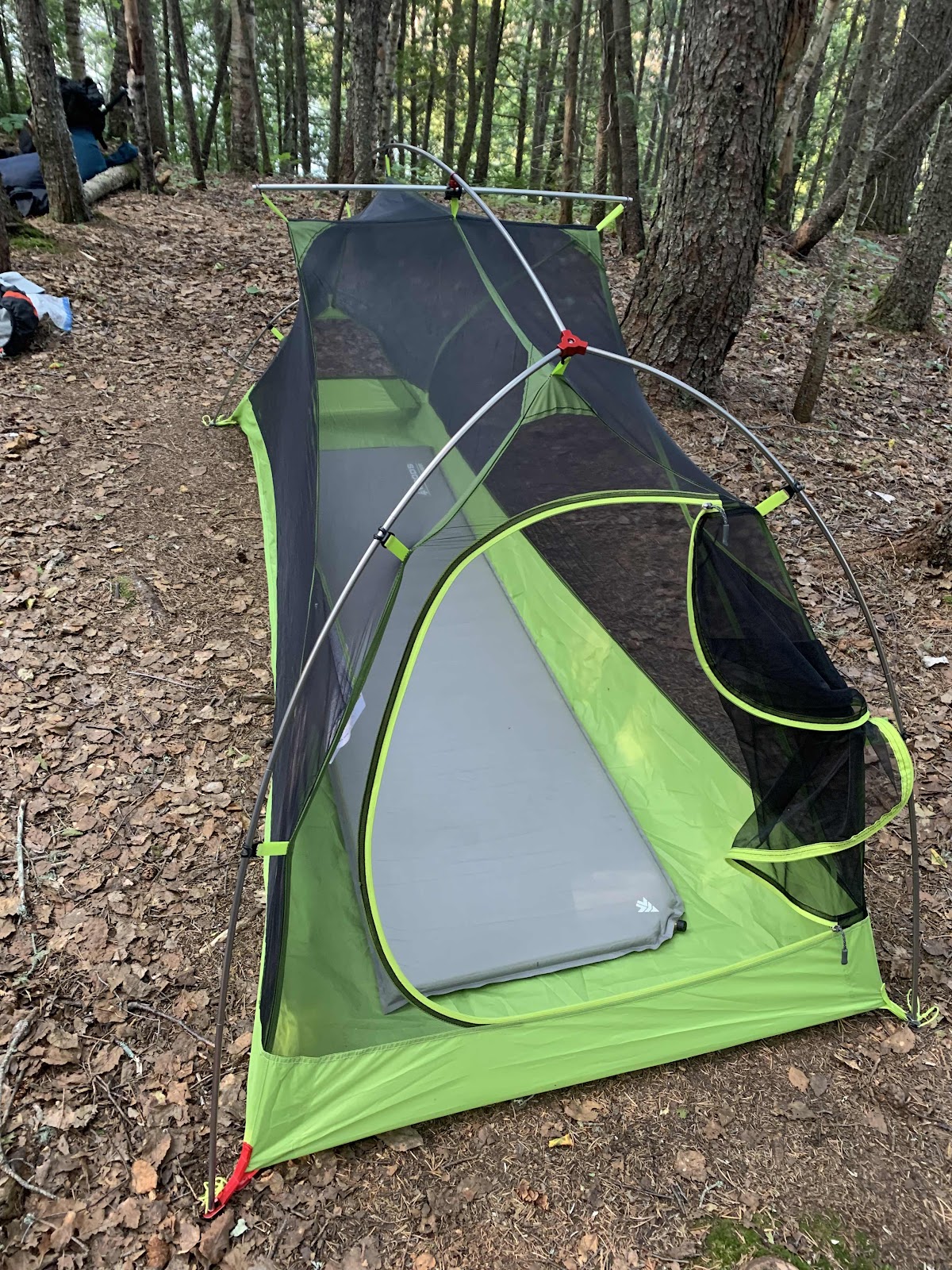
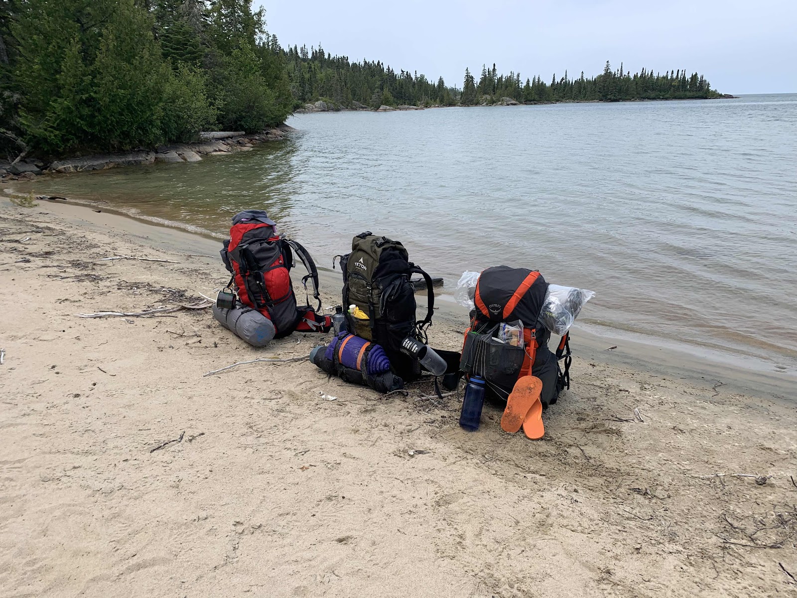
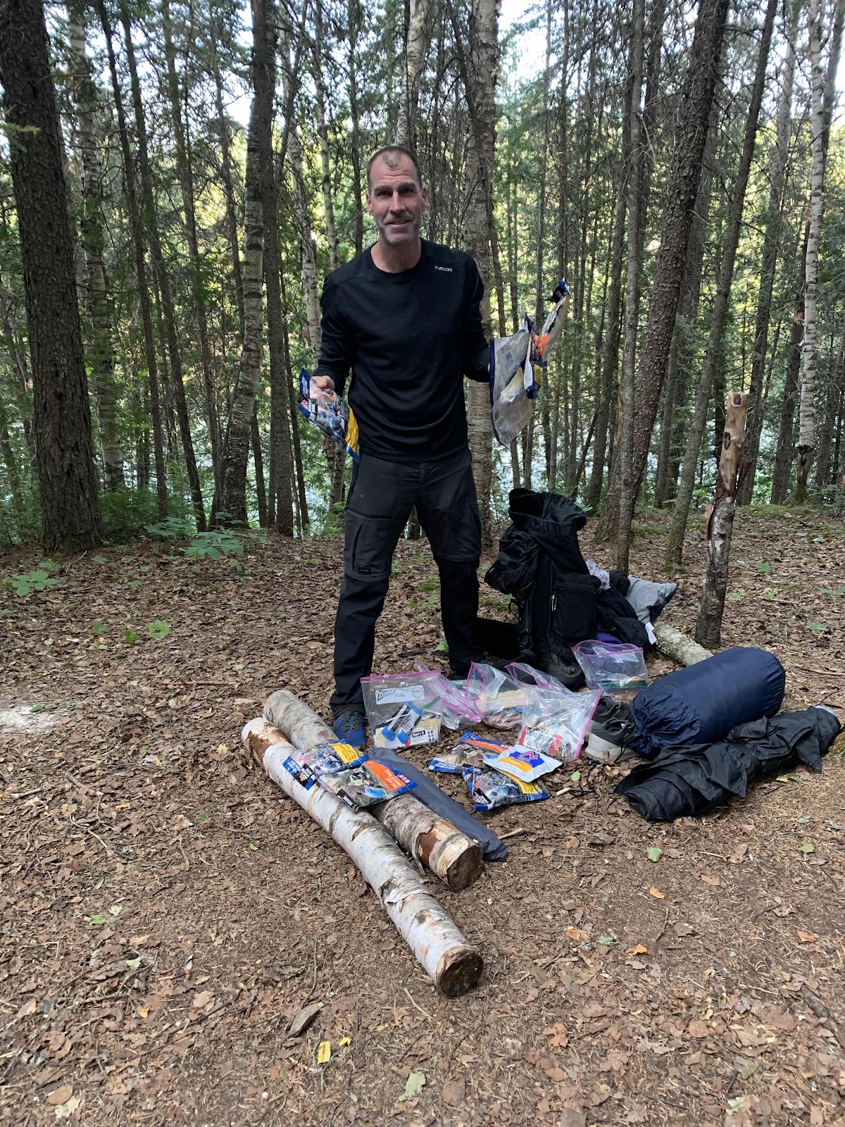
I bought an Osprey 55 L backpack a couple years ago and I love it. It is approximately 3 pounds and has an amazing amount of places to tuck,ttie and strap other equipment to.  I ended up buying a Teton lightweight one person backpacking tent online, it also weighed approximately 3 pounds. My sleeping bag was a lightweight 7°C rated bag which probably weighed close to 3 pounds as well. My sleeping pad is one thing that I wish I would’ve exchanged for something lighter. Although it was comfortable and did the job I think I would’ve benefitted from trading it in for something half is heavy. The other newly purchased item that I was very very happy with was my new jet boil stove. This also helped my companions as we shared the stove and allowed  them to not have to carry one, although they did help by bringing some fuel. Other equipment that I would’ve brought with me included a spoon, a gas cannister for the jetboil, A small first aid kit, some bug repellent and some bear spray, I also brought a headlamp and a bag of clothing which included extra underwear socks and a T-shirt and a raincoat. I reckon all those items I just mentioned were luxuries as I think I could’ve done the trip without them if I had to. 

Water. I am a big believer in Aquatabs. One small chlorine tablet would disinfect the already cool clear Lake Superior water in 1/2 an hour. Additionally, I carried a life straw which wasn’t needed, as KD’s bag water filtration system proved quite effective and efficient. 

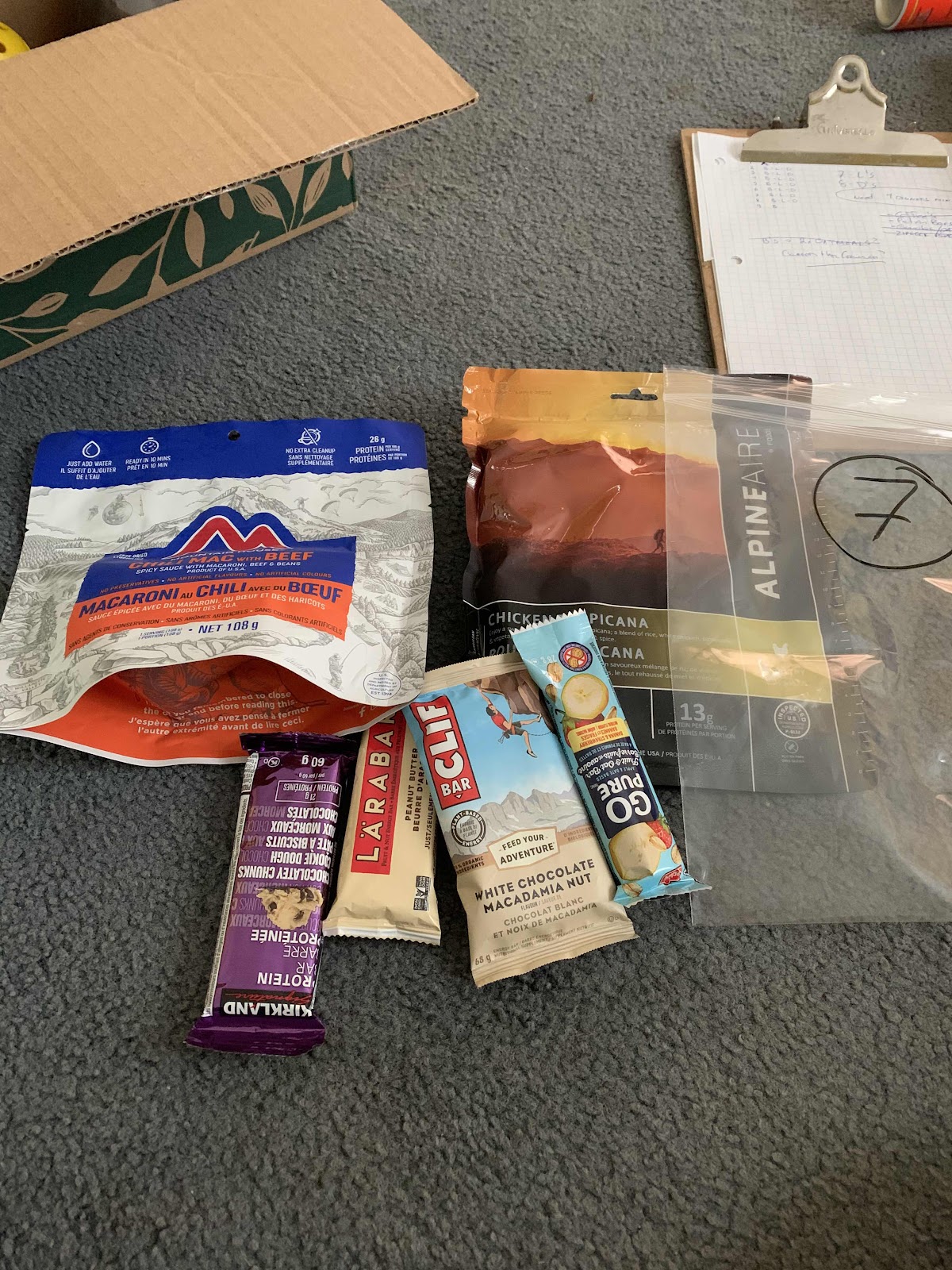
Food. My food plan was a bag of Costco keto granola and a small amount of powdered skim milk, this would constitute my breakfast for every day on the trail. Obviously some small ready to go Coffee packets were essential! There is nothing like trail Coffee out in the backcountry! 

At the onset we were planning for eight nights on the trail. Each day after breakfast would have consisted of to boil in a bag meals, two protein bars, one small bag of trail mix, And a fruit bar. I did my best to pack approximately 2800 cal for each day. And it was also rather surprising how after some of the most exerting days how little we actually felt like eating. But it was certainly important to try to consume those used calories because the next day never seemed any easier than the one we just completed. Each day of food weighed just over 1 pound each. It is important to really know what you’ll consume. Don’t bring unnecessary food and unbearable weight!

My trail companions shared a tent which was an excellent way to distribute weight. To make a long story short, like me, they probably had a few extra items that were not required or considered luxurious. PR had a pre-hike bag way in of about 42 pounds while KD tip the scales at over 45 pounds. Again it was tough to imagine these fine fellas who completed the Boston marathon having any issue carrying  these weights. But again the challenges of bad country hiking on a very tough and adverse trail is hard on anyone.But as PR famously said “ I thought we were going hiking, not to Golds Gym!”

We certainly had everything we needed. We had the right mindset and all the gear to make this trip successful. The advice to you as you may be thinking about doing this trip is this, everything adds up, you need to be as light as you think you can be for this trip. If you need it you need it but if you don’t I would leave it behind.


Monday, July 19, 2021

Pukaskwa Coastal Trail: Forward


The Coastal Trail in Pukaskwa National Park is often called Canada’s toughest trail. I for one, after experiencing the beauty and the beast of this trail, would have to agree. The route is a 58km (map miles, more on this later) out and back trail starting in the developed campground at the North end of the park. There is also an option to take a boat out to Swallow River and hike the trail one direction back north. I also suppose you could coordinate a pick up at North Swallow and hike southerly in one direction, although I have never heard of it being done that way. 

I hiked the first 35km of this trail from the campground past Oiseau Bay in the summer of 2019. My trail partner Dan and I accomplished this feat in a day and a half before my knees simply screamed “NO FURTHER”. I was carrying a 40lb pack on a 185frame (me). We turned around after lunch and made the return trip with two more nights along the way. Needless to say, much was learned on that trip and applied to my most recent outing that I will be documenting in the chapters of this blog. 

I’ve hiked extensively in Southern Ontario and New York State. There is nothing equal to Pukaskwa. The SUPERIOR life of the region, and the grandeur of this trail is epic. I look forward to sharing my latest experience with you, and hopefully it will help you should you decide to visit Canada’s toughest trail!

Best Backpacking,
Outdoor Easy.